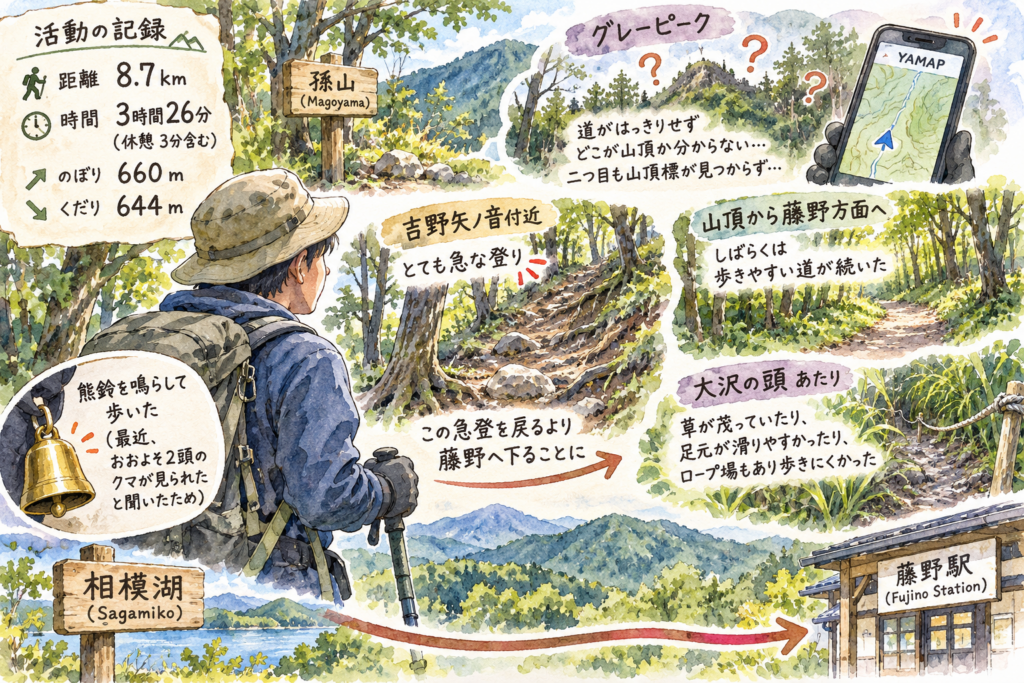
In an activity report published on November 17, 2026, a hiker described an 8.7 km outing that began on the Sagamiko side and ended toward Fujino Station after a change of route. The recorded time was 3 hours 26 minutes, including 3 minutes of rest, with 660 m of ascent and 644 m of descent.
After passing Magoyama, the hiker found no clear path to one of the route’s “gray peaks” and could not tell where its summit was, even while checking YAMAP. They also could not find a summit marker at the second gray peak. The climb near Yoshino Ya-no-ne was very steep, which contributed to the decision to descend toward Fujino rather than reverse that section.
The hiker described the trail toward Fujino as easy to walk immediately after the summit. Around Ōsawa-no-atama, however, overgrown grass, slippery ground and a rope section made progress more difficult. They carried and rang a bear bell because they had heard that roughly two bears had been seen recently; the report does not verify those sightings.